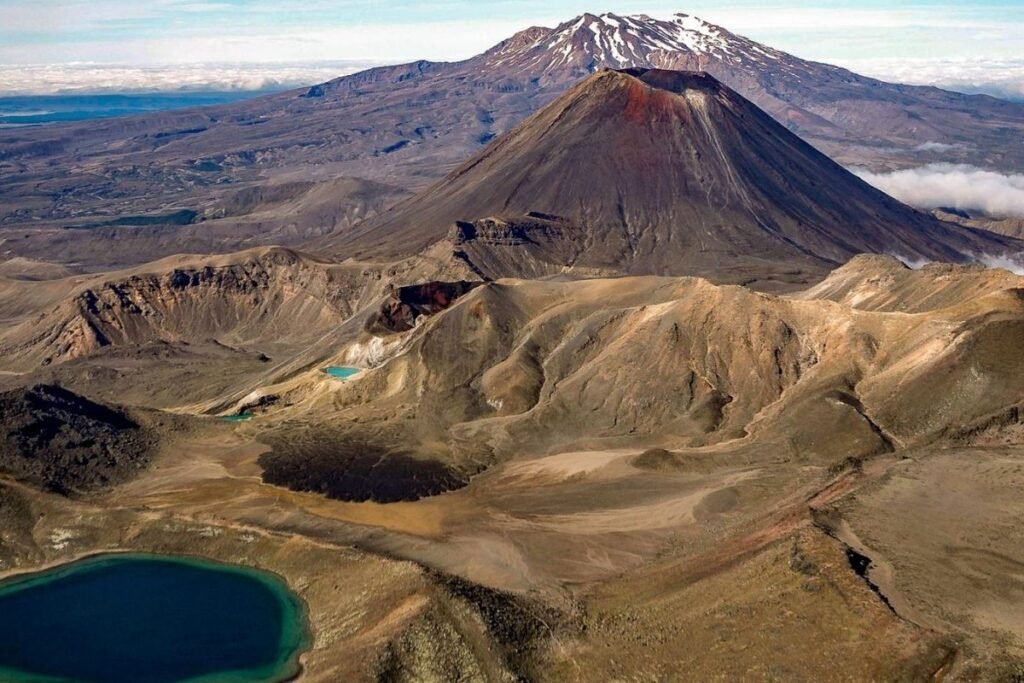
The Tongariro Alpine Crossing is often hailed as the best day hike in Aotearoa – New Zealand, and it’s easy to see why. This 19.4-kilometre trek through the heart of the North Island offers an unforgettable 6 to 8-hour adventure. Located in Tongariro National Park, the trail winds between two dramatic volcanic peaks — Mount Tongariro and Mount Ngauruhoe, known to many as “Mount Doom” from The Lord of the Rings. Along the way, you’ll encounter a breathtaking mix of natural wonder, from ancient lava flows and steaming vents to vivid emerald lakes and vast glacial valleys.
Unveiling the Wonders of the Tongariro Alpine Crossing
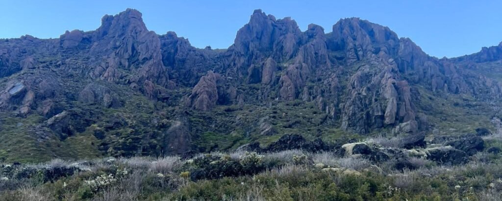
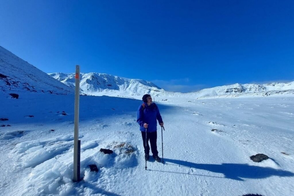
Get ready to step into a landscape shaped by powerful volcanic forces over thousands of years. The Tongariro Alpine Crossing isn’t just a hiking track — it’s a journey through an otherworldly environment that feels like it belongs to another planet.
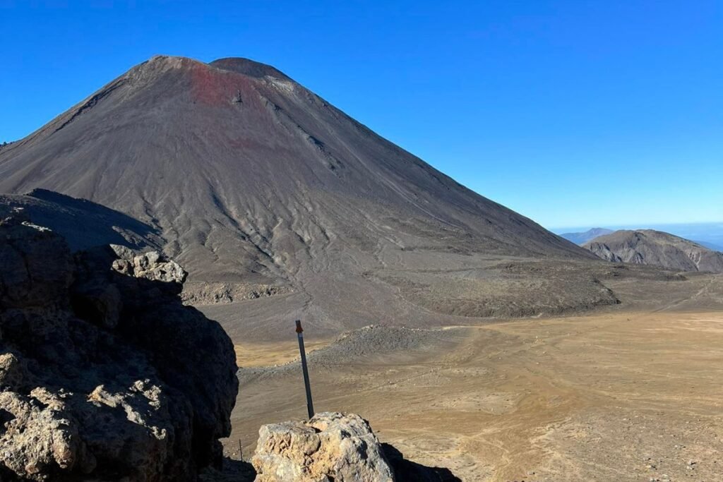
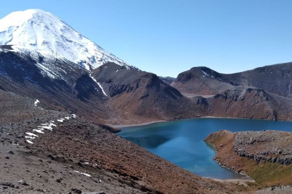
The trail passes between two towering peaks, each with its own character and legend. Mount Ngauruhoe (Mount Doom to film fans) and Mount Tongariro dominate the skyline as you navigate stark red craters, alpine meadows, and shimmering mineral lakes. The landscape constantly shifts underfoot from barren moonscapes to tussock-covered ridges, alpine flora, and steaming geothermal vents that remind you this is one of the most active volcanic regions in the world.
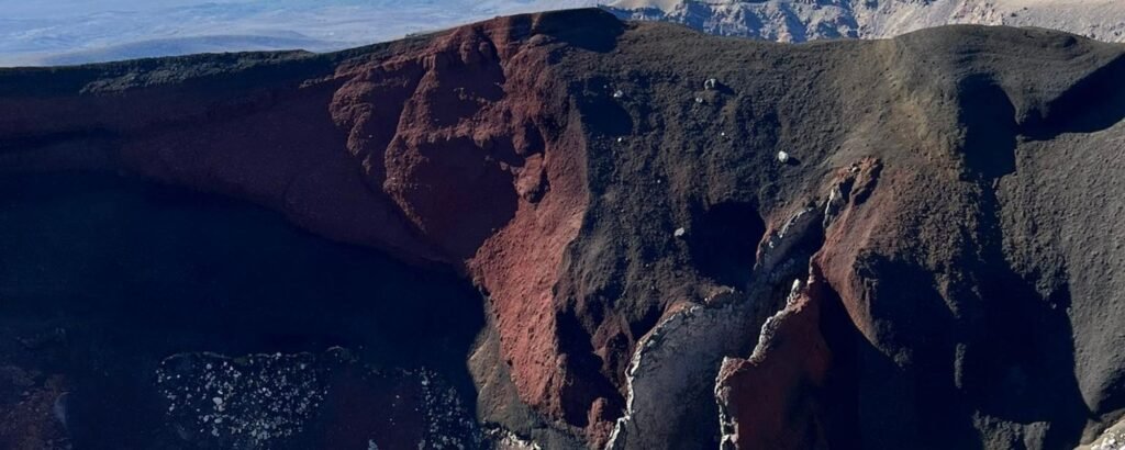
It’s a challenging climb at times, particularly the ascent to the Red Crater at 1,886 metres, but the panoramic views across the Central Plateau make every step worthwhile. You’re not just walking through a national park, you’re walking across sacred land where geology, legend, and cultural heritage converge.
Why the Tongariro Alpine Crossing Is So Remarkable
Few hikes in the world blend dramatic scenery, cultural depth, and cinematic history the way the Tongariro Alpine Crossing does. It’s not just a great walk, it’s a powerful experience.
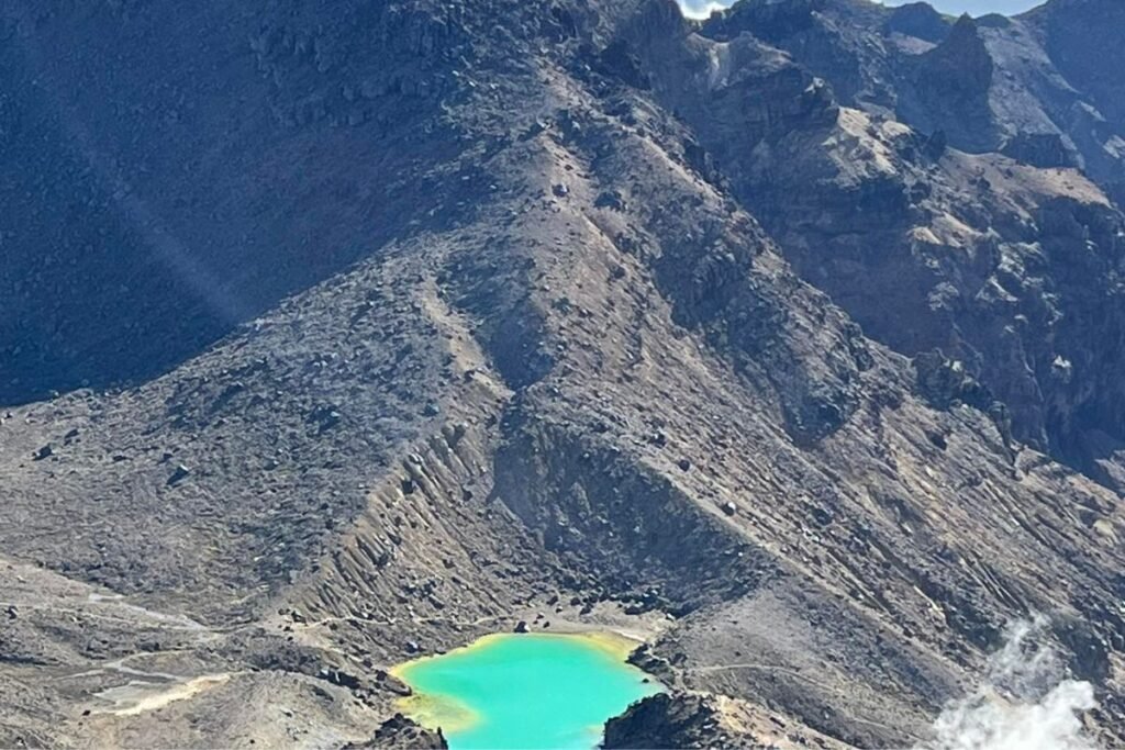
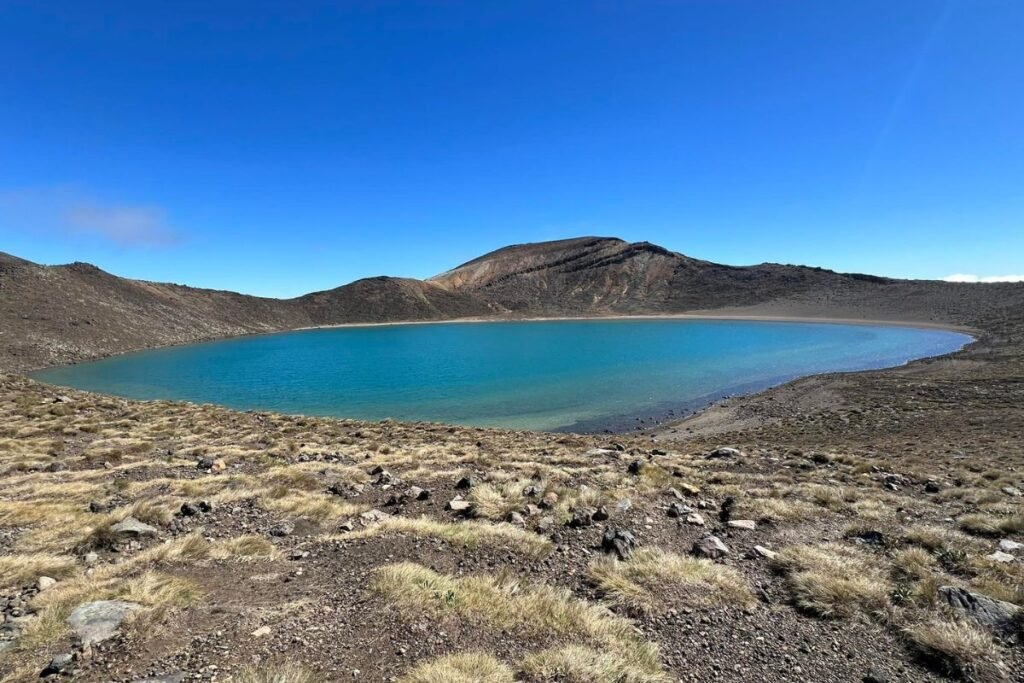
You’ll see nature at its most theatrical. Steam seeps from cracks in the earth, emerald lakes glow in surreal shades of turquoise, and volcanic rocks shift colour with the changing light. Every viewpoint feels like a reward, and every kilometre uncovers a new layer of the land’s story.
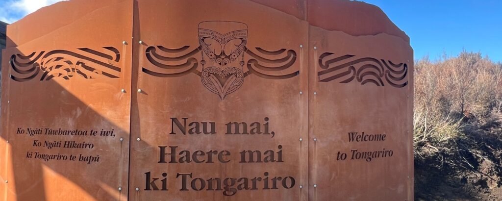
But the true heart of this hike lies in its cultural importance. For the Ngāti Tūwharetoa people, these mountains are sacred ancestors. Their stories are etched into the land, and respecting this space is part of what makes the journey so meaningful. This deep connection is one of the reasons why Tongariro National Park was the first site in the world to receive dual UNESCO World Heritage status for both natural and cultural significance.
Table of Contents
- Unveiling the Wonders of the Tongariro Alpine Crossing
- Why the Tongariro Alpine Crossing Is New Zealand’s Most Remarkable Day Hike
- A Fact about our Maunga (Mountains)
- Tongariro Alpine Crossing Statistics
- Planning Your Hike: The Essentials
- Getting There: Transportation Made Simple
- Trail Guide
- Essential Packing List
- Facilities on the Trail
- Where to Stay
- Safety Tips and Trail Etiquette
- Beyond the Crossing: Other Activities
- Final Thoughts
A Fact About Our Maunga (Mountains)
Ngā Maunga Tapu – The Sacred Mountains
Tongariro National Park is anchored by three dramatic peaks: Tongariro, Ngauruhoe, and Ruapehu. These volcanic mountains are not only geological marvels but hold deep spiritual significance for the local Māori, particularly Ngāti Tūwharetoa.
In 1887, Chief Horonuku Te Heuheu Tukino IV gifted the mountain peaks to the Crown in a tuku (a sacred act of customary lore) to protect their mana and ensure long-term conservation. This act formed the foundation of what would become New Zealand’s first national park.
Visitors are reminded that entering the summit areas is prohibited out of respect for the cultural significance of these maunga.
Tongariro is New Zealand’s most active volcanic area, with a long history of eruptions and geothermal activity. On Mount Ruapehu, an extraordinary interaction between magma and glacial meltwater in its crater lake creates the rare potential for explosive eruptions – a phenomenon found in only one other place on Earth. To truly grasp the force and beauty of this living landscape, you simply have to experience it.
Tongariro Alpine Crossing: Key Stats
- Distance: 19.4 km (12 miles)
- Elevation Gain: 841 metres (2,759 feet)
- Average Time: 7–8 hours (ranges from 6–11 hours)
- Difficulty: Challenging
- Location: Tongariro National Park, North Island
- Restrictions: No dogs, No drones, No bikes
Planning Your Hike: Essentials
📅When to Go
- November to April – Main Hiking Season
- This is the official Great Walk season for the Tongariro Alpine Crossing, when track conditions are most stable, and all facilities, shuttles, and hut services are running.
- November
- Early in the season, with cooler mornings and fewer crowds. Some snow may linger higher up, but it’s a great time to go if you’re well-prepared and want a quieter experience.
- December to February (Peak Season)
- Warm, settled weather and long daylight hours — but also very busy. Book shuttles and accommodation early, and expect full car parks.
- March to April (Late Shoulder Season)
- Cooler, crisp days and fewer hikers on the trail. Personally, we think this is the best time to go — if the weather holds, it’s absolutely stunning.
- May to September (Winter)
- The trail becomes an alpine route — snow, ice, and rapidly changing conditions make it suitable only with a Guided Tour. Guides provide gear like crampons and ice axes, along with expert support.
🚐Getting There: Transport Options
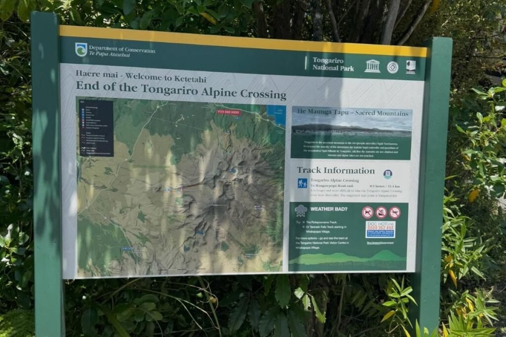
The track begins at Mangatepopo Car Park and finishes at Ketetahi Car Park, crossing dramatic volcanic terrain in Tongariro National Park. Since it’s not a loop, you’ll need to organise transport in advance — and during the peak season (October to April), keep in mind that Mangatepopo has a strict 4-hour parking limit. To avoid the stress, we highly recommend booking a shuttle or guided trek, which ensures smooth logistics and gives you more time to enjoy the journey without watching the clock.
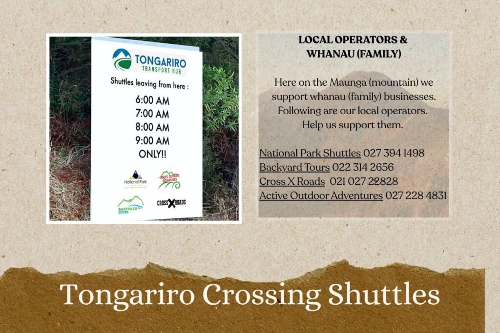
- Shuttle Services
- Operate return or one-way
- Recommended Providers:
- See image above. These are our local operators. Maori owned businesses. Whanau (family) Help us support them.
- Cost: $50–90 NZD per person
- Tip: Book your shuttle or guided trek early — spots fill up quickly, and many travellers are caught out by leaving it too late. Don’t be that person stuck at the trailhead or scrambling for a last-minute ride. A pre-booked option takes the stress out and lets you focus on the views, not the logistics.
- Two-Car Method
- Have one person drop the group off at Mangatepopo (the start point), then drive the vehicle around to Ketetahi (the end point) and park there. That driver then takes a pre-booked one-way shuttle back to Mangatepopo to begin the hike.
- It’s best to choose your fittest and fastest group member for this role — they’ll be starting the track about an hour later but can easily catch up to the group, who’ll be walking at a more relaxed pace. This option gives you your own car at the finish line without needing a full return shuttle for everyone.
- Taupō Shuttle Option
- A full return transfer from Taupō, including drop-off at Mangatepopo and pick-up from Ketetahi at the end of your hike.
- Cost: From $120 NZD per person
- This is a convenient option for those staying in Taupō, but it requires precise timing, as shuttles operate on a fixed schedule. If you miss the final pick-up, be aware that there are no backup transport options — your only real choice may be to hitchhike back to Taupō. Plan your pace and breaks carefully to avoid getting stranded.
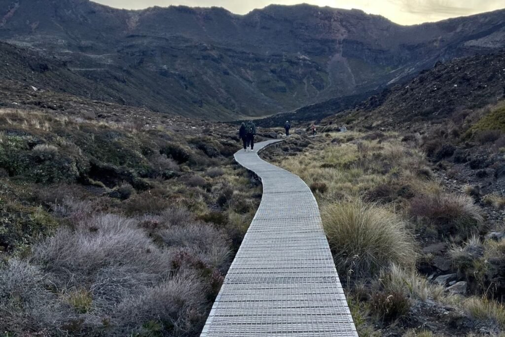
🥾Trail Guide: Section by Section
Mangatepopo to Soda Springs
- Difficulty: Easy
- Time: 1 hour
- Terrain: Flat boardwalk
- Highlights: Stream crossings, lava flows
- Best Start Time: 6–7am
Soda Springs to South Crater
- Difficulty: Challenging
- Time: 1–2 hours
- Elevation: 1400m to 1600m
- Highlights: Devil’s Staircase, panoramic views
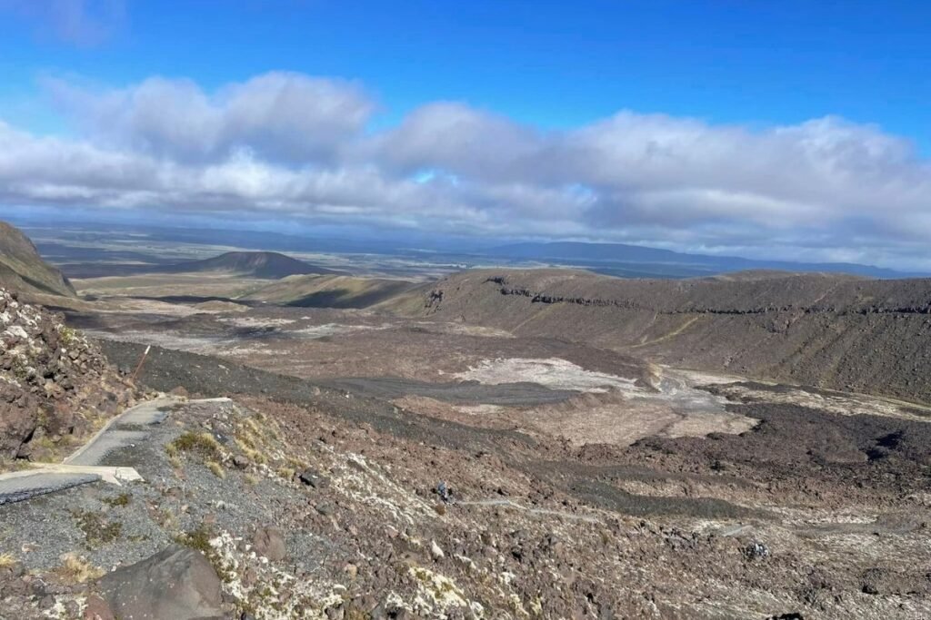
South Crater to Red Crater Summit
- Difficulty: Moderate to challenging
- Time: 1–1.5 hours
- Highlights: Unnamed alpine lake, Red Crater, highest point of the track
Red Crater Summit to Blue Lake
- Difficulty: Steep descent
- Time: 30 minutes
- Highlights: Emerald Lakes, scoria terrain, geothermal activity
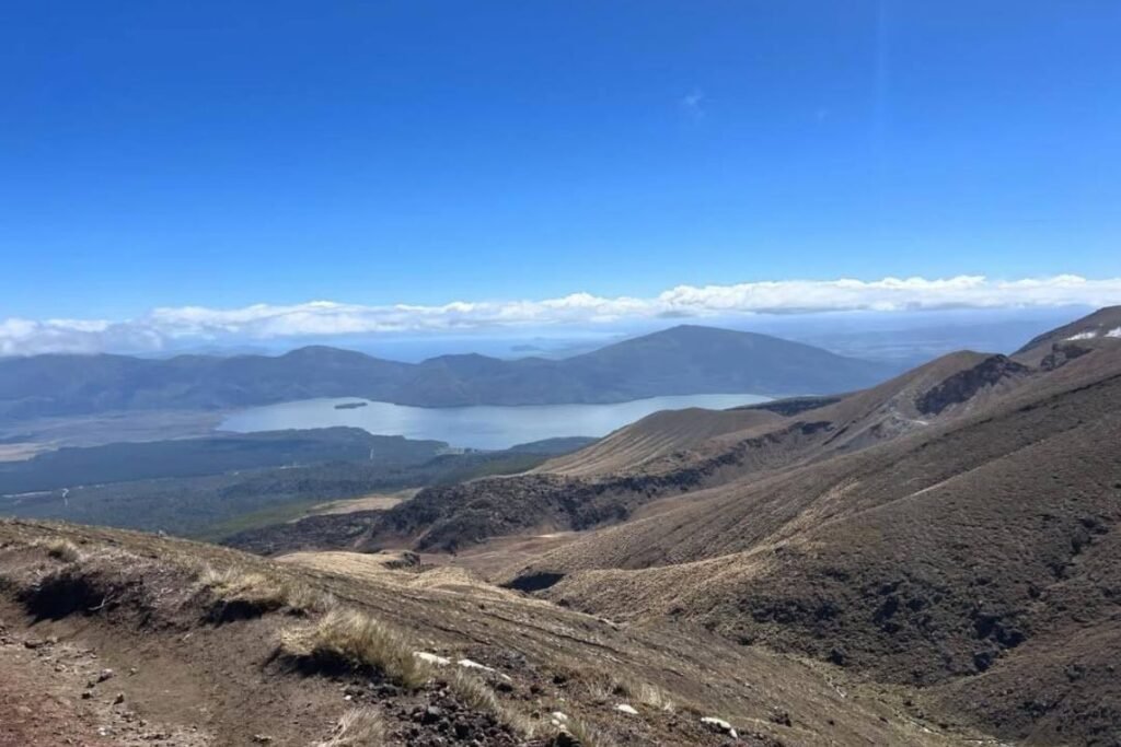
Blue Lake to Ketetahi Hut
- Difficulty: Moderate
- Time: 1 hour
- Views: Lake Rotoaira, Lake Taupō
Ketetahi Hut to Car Park
- Difficulty: Moderate to challenging
- Time: 2 hours
- Terrain: Forest paths, rocky slopes, stream crossings
- Tip: This long downhill section is physically demanding. Hiking poles are highly recommended to protect knees and improve stability.
Remember: this isn’t a race. Take your time, appreciate the views, and respect the sacred whenua you’re walking through.
🎒Essential Packing List
Must-Haves:
- 2–3 litres of water per person
- High-energy food and snacks
- Well-worn hiking boots or really sturdy walking shoes
- Lightweight backpack
- Sun protection: hat, sunscreen, sunglasses
- First aid kit
- Toilet paper
- Power bank to charge up your phone as you will be taking alot of photos and don’t want to miss that perfect shot.
- Hiking poles (highly recommended)
Weather-Dependent Extras:
- Waterproof jacket and warm layers
- Gloves and beanie
- Extra thermal layers
🚻Facilities on the Trail
- Toilets
- There are 8 toilet stops spaced out along the Tongariro Alpine Crossing, including at both trailheads (Mangatepopo and Ketetahi), Soda Springs, Red Crater, and the Emerald Lakes. These are long-drop toilets and may not have toilet paper — so it’s wise to bring your own, just in case.
- Water
- There are no drinking water stations along the track. Streams and lakes are not safe to drink from due to volcanic minerals and possible contamination. You’ll need to carry all your own water — at least 2–3 litres per person, more on hot days.
- Rubbish
- This is a pack in, pack out hike. There are no rubbish bins along the trail, and leaving waste behind damages the fragile alpine environment. Bring a small bag to carry out your own rubbish — including tissues and food scraps — and leave the trail better than you found it.
🏨Where to Stay Nearby
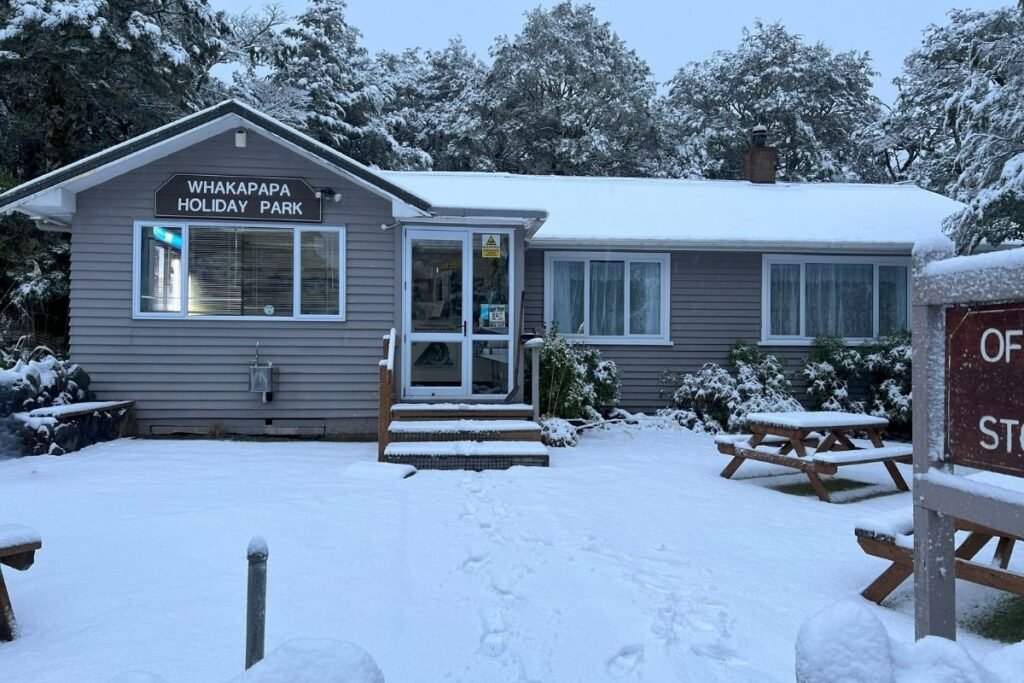
- Whakapapa Holiday Park
- A well-equipped holiday park in Whakapapa Village offering powered and non-powered sites, hot showers, kitchen, laundry, fast WiFi, and an on-site shuttle to the Tongariro Alpine Crossing. BONUS: They have an onsite shuttle to the crossing (fee applies)
- 📅 Book here: Whakapapa Holiday Park
- Mangahuia Campsite (DOC)
- A peaceful riverside Department of Conservation campsite with 21 basic non-powered/tent sites (15 suitable for campervans). Compost toilets and river water (boil before use). Bookings are required via DOC’s online system.
- 📅 Book here: DOC Mangahuia Campsite
- Kiwi Camp – Waimarino (National Park) Village
- A budget-friendly KiwiCamp ‘park & ride’ site offering free camping and key-access to showers, toilets, laundry, and kitchen via KiwiCash. Ideal and affordable for crossing climbers.
- 📅 Book here: KiwiCamp Waimarino (National Park) Village
- Tongariro Holiday Park
- Located in Tongariro National Park, this site provides powered and non-powered sites, cabins, full amenities, and is very close to trailheads and shuttles for hikers.
- 📅 Book here: Tongariro Holiday Park
📝Safety Tips and Etiquette
- Check the Weather Before You Go
- Get up-to-date mountain forecasts for Tongariro National Park, including temperature, wind, rain, and snow conditions — crucial for planning and staying safe
Official MetService mountain forecast
- Get up-to-date mountain forecasts for Tongariro National Park, including temperature, wind, rain, and snow conditions — crucial for planning and staying safe
- Register Your Plans with DOC
- Filing an Outdoor Intentions form or visiting a DOC centre means someone knows where you’ll be and when — a key safety step if something goes wrong
Official DOC Outdoor Intentions steps
- Filing an Outdoor Intentions form or visiting a DOC centre means someone knows where you’ll be and when — a key safety step if something goes wrong
- Trail and Cultural Guidelines
- Stick to marked trails — going off-track is dangerous and damages fragile volcanic ecosystems
Respect Cultural Sites — the summit areas are tapu; climbing peaks like Ngauruhoe is prohibited and considered disrespectful
- Stick to marked trails — going off-track is dangerous and damages fragile volcanic ecosystems
- Timing & Hydration Tips
- Start early — weather can shift fast, and daylight is precious
Take regular breaks, carry enough water, and leave no trace — pack out what you bring in
- Start early — weather can shift fast, and daylight is precious
🌊Other Walks and Activities Nearby
- Waitonga Falls Track
- A 4 km return walk along mountain-beech and kaikawaka forest leads to Tongariro’s highest waterfall at 39 m—Waitonga Falls. The well-formed track begins 11 km up Ohakune Mountain Road and offers dramatic views of Mt Ruapehu, the Rotokawa wetlands, and the falls themselves
- Tama Lakes Hike (great bad-weather option)
- This loop through volcanic terrain climbs above Whakapapa Village toward the Lower and Upper Tama Lakes—two scenic crater lakes nestled between Mt Ruapehu and Mt Ngāuruhoe. Though exposed and weather-dependent, it’s a solid choice on days when the Tongariro Crossing isn’t viable. Bring navigation skills and proper gear if cloud or snow closes in.
- Tawhai Falls (“Gollum’s Pool”)
- Just off SH48, a quick 600 m return walk leads to Tawhai Falls, famously used in The Lord of the Rings as “Gollum’s Pool”. The easy trail through mountain forest ends at a photogenic pool beneath a cascading fall—great for a short break before or after your main hike.
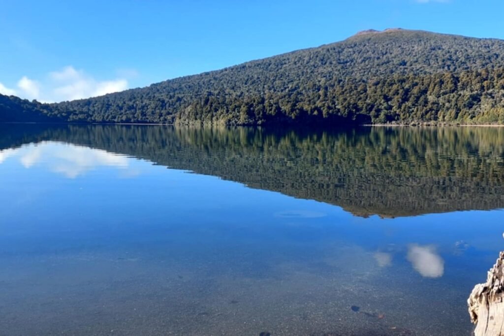
- Lake Rotopounamu Track
- A 5–6 km loop through native bush around the serene waters of Lake Rotopounamu, at the foot of Mt Pihanga. This easy-to-moderate hike is family and nature-lover friendly, with birdlife, picnic spots and gentle well-marked trails. We do this hike often and its a good 2 hours with stops.
- Tokaanu Thermal Pools (ideal for recovery)
- Relax post-hike at Tokaanu Thermal Pools on the south shore of Lake Taupō—heated public pools (~36 °C) plus private mineral tubs (39–41 °C) nestled amid calming bus. A classic post-Tongariro treat with therapeutic waters that soothe legs and spirits alike.
- Explore Whakapapa Village
- The alpine village on Mt Ruapehu’s flanks is the hub for mountain walkers and skiers. It hosts the Tongariro National Park Visitor Centre, historic Chateau Tongariro, ski facilities like Skotel, and access to short tracks such as Silica Rapids or Summits Walk
🧭 Final Thoughts
The Tongariro Alpine Crossing is more than just a day hike — it’s a journey through a landscape shaped by volcanic power, ancient stories and raw natural beauty. From steaming craters to sacred peaks, every step offers a glimpse into the geological and cultural heart of Aotearoa.
With the right preparation, respect for the environment and a flexible mindset, this trail can be both challenging and deeply rewarding. Whether it’s your first alpine hike or one of many, the memories you’ll carry from Tongariro will stay with you long after your boots are off.
🌍 Travel Planning Resources
These are the tools we personally use and trust when planning our travels from finding a place to stay to booking activities, transport and insurance. Let your Tohu guide you — Trust the Journey and follow what feels right for you.
- ✈️Flights – Compare great deals with Trip.com then Kiwi.com for flexible, affordable options.
- 🚐 Campervans – Compare rental deals with Motorhome Republic across Aotearoa and beyond.
- 🛏️ Stays – Compare hotels on Trip.com and TripAdvisor or Booking.com.
- 🚐 Rental Cars – Compare prices and book through Airport Rentals by Motorhome Republic for trusted brands and easy airport pickup.
- 🎟️ Activities – Browse tours and experiences on Viator, Get Your Guide, or TripAdvisor
- 🚆12Go Asia – Compare and book trains, buses, and ferries across Asia in one place with 12Go.
- 🛡️ Travel Insurance – Get flexible short-term coverage with Insubuy for your next holiday.
- 🔒 Protect Your Privacy with a VPN – We recommend Surfshark VPN for secure and private browsing while travelling. It’s fast, affordable and works worldwide — perfect for public Wi-Fi at airports, cafes and hotels.
- 📱 Travel eSIM – Stay connected with Airalo
- 💼 Lounge Access – Treat yourself with Priority Pass – for UK or US
- 🎶 Events & Concerts – Book tickets worldwide through Ticketmaster.
🧭 Note: Some booking links can be a bit shy when you’re using a VPN. If one doesn’t open, try pausing your VPN or switching to a different server location or secure Wi-Fi network to get things flowing again.
Whaia te iti kahurangi, ki te tuohu koe, me he maunga teitei
Pursue that which is precious, and if you bow your head, let it be to a lofty mountain