
The Bernese Oberland is one of Switzerland’s most spectacular hiking regions, with trails winding through Alpine meadows, mountain villages, forests and valleys surrounded by towering peaks. From the mountains above Grindelwald to the waterfalls of Lauterbrunnen and the walking tracks around Wengen and Mürren, there are countless opportunities to explore on foot. One of the best things about hiking in this region is the variety, with everything from gentle valley walks to challenging mountain trails. An extensive network of gondolas, mountain railways and buses also makes it possible to combine several walking routes in a single day.
Is Early June a Good Time to Hike in the Bernese Oberland?

Early June can be a wonderful time to explore the Bernese Oberland, but it comes with a few surprises. While the valleys are turning green and wildflowers are beginning to appear, snow can still cover many of the higher mountain trails, and some cable cars and seasonal attractions may not yet be operating. The weather can also change quickly, bringing rain, mist and sunshine within a matter of days. However, there are some real advantages to visiting at this time of year, including quieter walking tracks, fewer tourists and beautiful scenery throughout the lower valleys. With flexible plans and a willingness to explore alternative routes, there is still plenty of hiking to enjoy.
Our Experience Hiking in the Bernese Oberland

We arrived in Grindelwald on 1 June 2024, excited to spend six nights exploring the Bernese Oberland. What we hadn’t anticipated was how much snow would still be covering the higher trails. Our first two days brought rain and mist, but visibility was good enough to appreciate the beautiful surroundings, even without the sweeping mountain views. Fortunately, our Airbnb host was an experienced hiker who loved sharing her favourite local walking tracks. Each evening, she would sit with us, ask about our adventures and help us plan the following day. We followed much of her advice, discovering quieter routes around Bussalp, Bort, Holenstein and Aspen that we might otherwise have missed. A local bus driver also helped us avoid a snow-covered trail by directing us onto a safer route. Armed with a four-day Bernese Oberland Pass, we made the most of every opportunity, often catching the first mountain transport of the morning and returning on some of the last services. Most evenings, we arrived back at our accommodation around 6–7 pm, ready for dinner and bed. By our third day, the sunshine finally arrived, revealing the magnificent mountain scenery we had been hoping to see. Although several hikes on our original wish list remained closed, including Schynige Platte, the change of plans led us to some unforgettable walking experiences.
Table of Contents
- Is Early June a Good Time to Hike in the Bernese Oberland?
- Our Experience Hiking in the Bernese Oberland
- Hiking in the Bernese Oberland – What to Expect
- Our Favourite Hiking Trails Around Grindelwald
- Hiking Around Wengen, Lauterbrunnen and Mürren
- Hiking Around Interlaken and Lake Brienz
- Popular Bernese Oberland Hikes That May Still Be Closed in Early June
- Planning Your Bernese Oberland Hiking Adventures
- Final Thoughts
Hiking in the Bernese Oberland – What to Expect
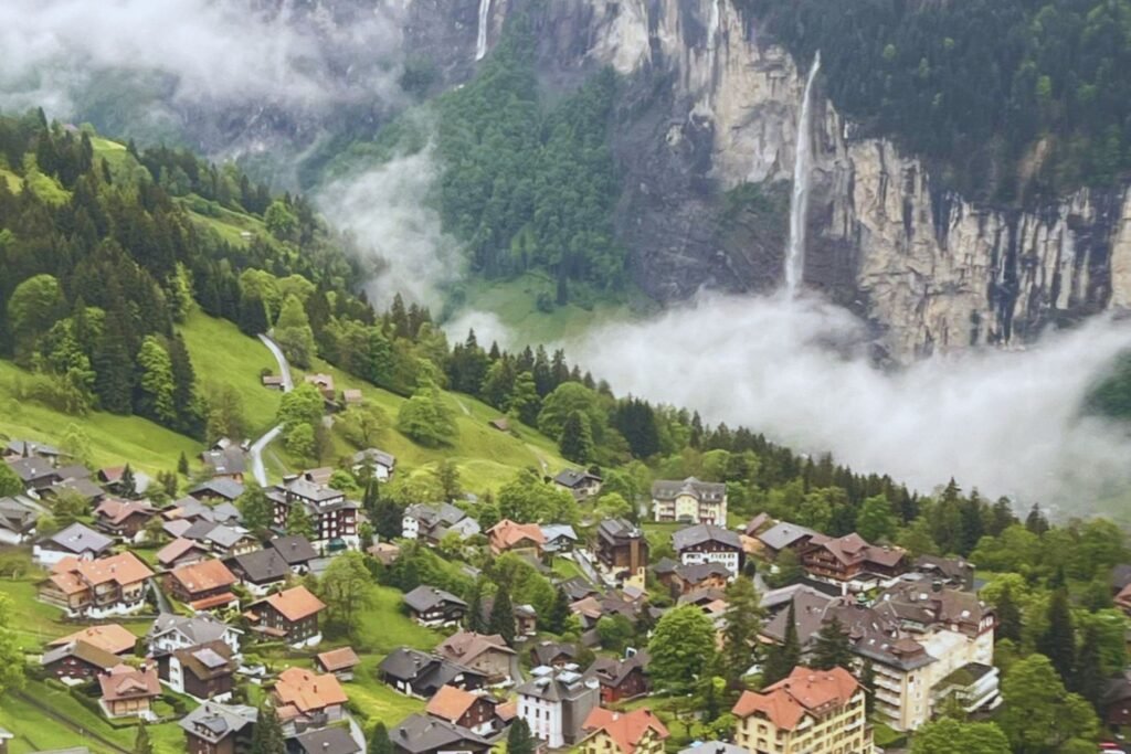
With Grindelwald as a base, visitors can access walking routes throughout the Jungfrau Region, from short village walks to demanding mountain hikes. The extensive transport network also allows walkers to reach higher elevations without tackling every climb on foot.
Choosing the right trail depends on more than distance. Elevation changes, terrain and weather conditions all influence the difficulty of a walk, making it important to understand the different hiking routes before setting out.
The main hiking areas around Grindelwald include:
- Grindelwald and First: Mountain paths, Alpine pastures and walking routes connecting Bussalp, Bort and the First area.
- Männlichen and Holenstein: Scenic mountain trails, forest paths and downhill walks towards Aspen and Grindelwald.
- Wengen and Lauterbrunnen: Walking routes linking mountain villages with the Lauterbrunnen Valley, famous for its waterfalls and steep cliffs.
- Mürren and Allmendhubel: Elevated walking trails, flower meadows and views across the surrounding mountains.
- Interlaken and Lake Brienz: Forest walks, viewpoints, waterfalls and lakeside paths that offer a different perspective of the region.
Understanding Trail Difficulty and Elevation
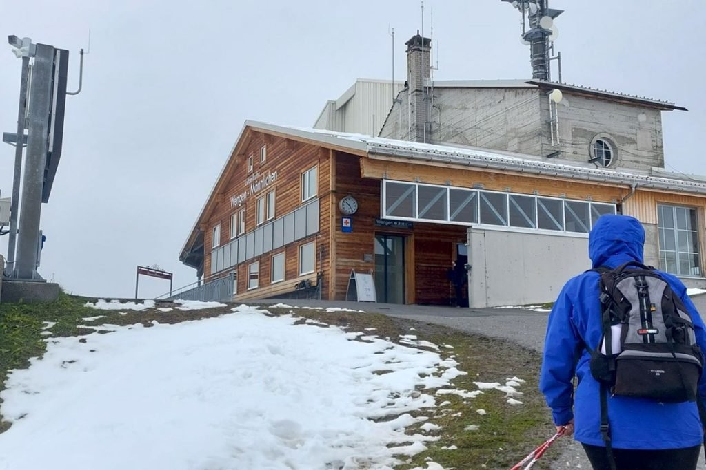
Hiking trails in Switzerland are generally well signposted, with yellow signs showing destinations and estimated walking times. However, distance alone doesn’t determine how difficult a walk will be. Elevation changes, steep descents, uneven surfaces and weather conditions can make a relatively short trail more demanding than expected.
Swiss hiking routes are commonly identified by their markings:
- Yellow signs: Ordinary hiking trails, generally suitable for walkers with appropriate footwear and reasonable fitness.
- White-red-white markings: Mountain hiking trails that may involve steep terrain, narrow paths and exposed sections.
- White-blue-white markings: Alpine routes requiring specialist skills, equipment and experience.
These markings are important when choosing a route, particularly during early summer when snow may still cover sections of higher trails.
Hiking Seasons in the Bernese Oberland
The main hiking season generally runs from June through September, although the exact opening dates vary according to elevation and seasonal conditions. Lower valley paths are often accessible earlier, while some high-altitude routes may not become suitable for hiking until July.
July to September generally offers the widest choice of mountain trails, although conditions can still change quickly. Travellers visiting during the shoulder season should be prepared for a more limited selection of higher-elevation walks.
Our Favourite Hiking Trails Around Grindelwald
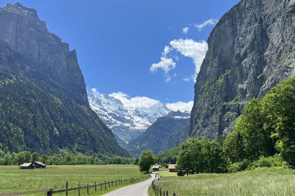
Our first two hiking days around Grindelwald took us along quieter mountain paths recommended by our Airbnb host. With rain and mist affecting the higher viewpoints, these routes gave us the opportunity to discover another side of the region.
Bussalp to Bort and Männlichen to Holenstein and Aspen became two of our favourite walks, each offering a different landscape and plenty to appreciate despite the weather.
Bussalp to Bort and Grindelwald First
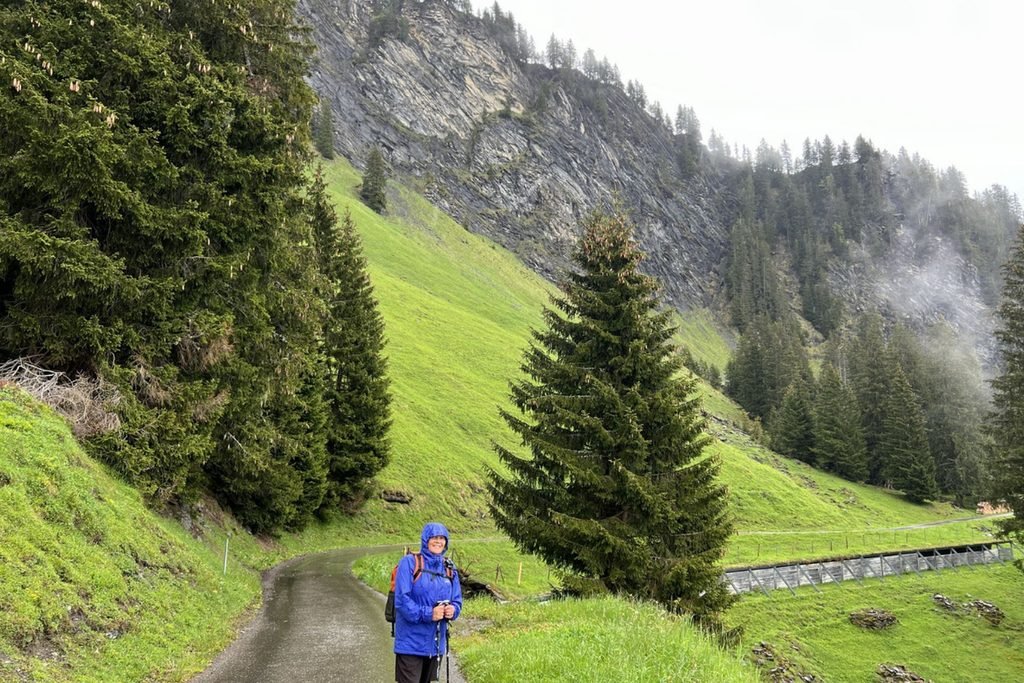
Our first hiking adventure began with a bus ride from Grindelwald towards Bussalp, high above the village. We’d planned to follow one of our host’s favourite mountain routes, but recent snowfall had made sections of the higher trails inaccessible.
Fortunately, our bus driver knew the conditions and directed us towards a safer walking track. It was advice we were grateful to receive, especially as we hadn’t expected so much snow at the beginning of June.
Despite the rain and mist, we still enjoyed the scenery along the way:
- Alpine pastures and mountain slopes, with sections disappearing into the low cloud.
- Occasional glimpses of the surrounding peaks as the mist shifted.
- Peaceful walking tracks, with very few other hikers around.
From Bussalp, we followed the trail towards Bort, before continuing uphill to Grindelwald First and its famous First Cliff Walk.
Unfortunately, thick cloud obscured much of the mountain panorama. Even so, walking along the suspended metal walkway was an experience in itself.
With the higher hiking trails still closed because of snow, we changed our plans:
- Took the gondola from First back down to Grindelwald First Terminal.
- Walked through the village towards Grindelwald Terminal, completing our first day of exploring.
Would we recommend this walk? Absolutely, particularly for anyone who enjoys quieter mountain paths. However, the route from Bussalp towards Bort should only be attempted when conditions are suitable. Check with local transport staff or the tourist information centre before setting out, especially early in the season.
Männlichen to Holenstein, Aspen and Grindelwald
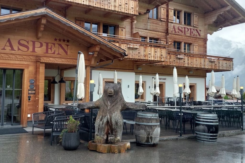
Our second day brought more rain and mist, but we weren’t about to let the weather keep us indoors. Following another recommendation from our Airbnb host, we caught the gondola from Grindelwald Terminal to Männlichen, where we began our downhill hike towards Holenstein.
Männlichen is famous for its views of the Eiger, Mönch and Jungfrau, but the low cloud meant we missed much of the mountain panorama. Nevertheless, the scenery along the trail was beautiful in its own way.
As we descended, the landscape gradually changed:
- Männlichen to Holenstein: Open Alpine pastures and mountain slopes, with glimpses of the surrounding scenery through the mist.
- Holenstein to Aspen: Quieter walking tracks, wooded sections and a noticeable change in vegetation as we lost elevation.
- Aspen to Grindelwald Terminal: The final stretch of our downhill walk, completing another rewarding day despite the weather.
What we particularly enjoyed was the changing landscape as we descended, from open mountain surroundings to sheltered forest paths. It was a completely different experience from the higher viewpoints.
Without our host’s recommendation, we might have overlooked this route entirely, especially on a day when the weather wasn’t ideal for sightseeing.
Our tip: Don’t dismiss a hiking day simply because the mountains are covered in cloud. Lower and mid-altitude trails can still be rewarding when conditions are safe. However, downhill doesn’t always mean easy, particularly when wet tracks become slippery.
Hiking Around Wengen, Lauterbrunnen and Mürren
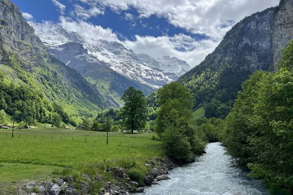
By our third day in the Bernese Oberland, the rain had finally cleared, and the sunshine revealed the mountain scenery we’d been waiting to see. After two days of walking through mist and cloud, it was a completely different experience. We had a big day planned, combining mountain transport with several walking trails through Wengen, Lauterbrunnen and Mürren.
This became one of our busiest and most memorable hiking days, with everything from mountain villages and waterfalls to forest paths and elevated walking tracks. Our Bernese Oberland Pass made it possible to cover so much ground without worrying about purchasing separate tickets for every journey.
Wengen to Lauterbrunnen
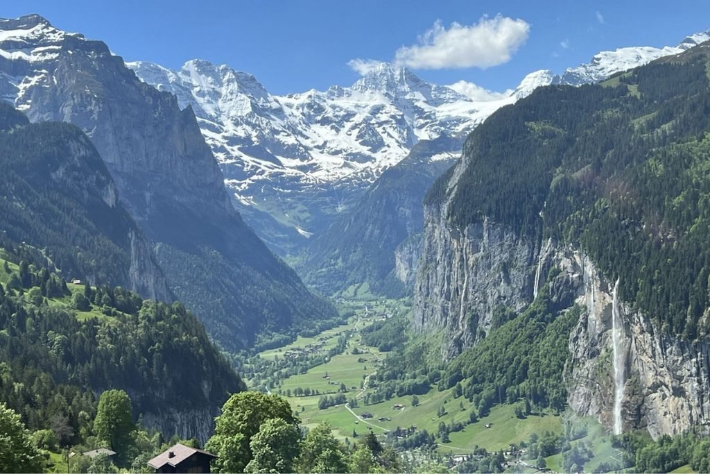
We started the morning by catching the gondola from Grindelwald Terminal to Männlichen, this time enjoying the spectacular mountain views that had been hidden by cloud the previous day.
From there, we travelled down to Wengen, a beautiful car-free Alpine village overlooking the Lauterbrunnen Valley. Rather than catching the train to Lauterbrunnen, we decided to explore the downhill walking trail.
Along the way, we enjoyed:
- Traditional Swiss houses scattered across the mountainside.
- Green Alpine pastures with beautiful views of the surrounding peaks.
- Changing valley scenery, with the towering cliffs of Lauterbrunnen becoming more prominent as we descended.
- Plenty of photography stops, especially with the sunshine finally revealing the mountain landscape.
The walk gave us a completely different perspective of the Lauterbrunnen Valley, gradually taking us from the elevated village of Wengen down towards the valley floor.
Our tip: Walking from Wengen to Lauterbrunnen is a rewarding alternative to the train, particularly in clear weather. However, the descent can be demanding on the knees, so wear comfortable hiking shoes and allow plenty of time to enjoy the journey.
Lauterbrunnen to Stechelberg – Walking Through the Valley of Waterfalls
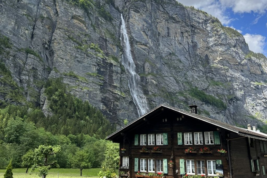
From Lauterbrunnen, we continued on foot towards Stechelberg, following the valley floor beneath the enormous cliffs on either side. After the steeper mountain trails we’d walked earlier, this was a welcome change of pace.
The Lauterbrunnen Valley is famous for its waterfalls, and with the sunshine finally making an appearance, the scenery was spectacular.
Along the way, we enjoyed:
- Towering waterfalls plunging from the cliffs, with smaller cascades appearing along the surrounding slopes.
- Green fields and sheer rock faces, creating a beautiful contrast against the clear skies.
- Gentle valley walking tracks, offering a much easier route than the steep descent from Wengen.
- A detour towards the waterfalls, where we left the main path to explore a little farther before continuing towards Stechelberg.
This became one of the highlights of our day. Walking beneath the enormous cliffs gave us a completely different perspective of the Lauterbrunnen Valley, particularly after spending the morning high above it.
Our tip: The Lauterbrunnen to Stechelberg walk is an excellent option for visitors who prefer less demanding trails. The relatively gentle valley floor makes it suitable for a leisurely walk, while public transport connections along the route allow you to shorten the journey if needed.
Mürren, Allmendhubel and Winteregg
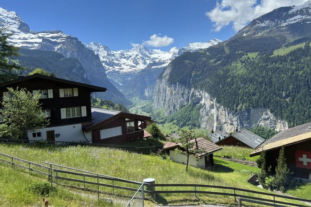
After reaching Stechelberg, we made our way up to Mürren, a beautiful car-free Alpine village perched high above the Lauterbrunnen Valley, with impressive views towards the Eiger, Mönch and Jungfrau.
With the sunshine continuing, we had the perfect opportunity to explore more of the mountain walking tracks.
Our afternoon included:
- Mürren: Exploring the elevated village and enjoying the magnificent mountain scenery.
- Allmendhubel: Taking the funicular up to this popular mountain viewpoint, where we followed one of the loop walking tracks before returning towards Mürren.
- Mürren to Winteregg: Walking along a scenic trail above the Lauterbrunnen Valley, with beautiful mountain views and a convenient railway connection at Winteregg.
Allmendhubel is particularly popular during the warmer months, when its Alpine meadows are filled with wildflowers. Several hiking routes begin here, from shorter circuits to more demanding mountain trails.
But our day wasn’t finished yet!
With the weather finally clear, we decided to return to Grindelwald First for another visit to the First Cliff Walk.
What a difference two days made! On our first visit, thick cloud had hidden almost everything. This time, the sunshine revealed the surrounding peaks and magnificent mountain scenery we’d missed.
Returning to First was absolutely worth it, and a wonderful way to finish one of our busiest days exploring the Bernese Oberland.
Hiking Around Interlaken and Lake Brienz
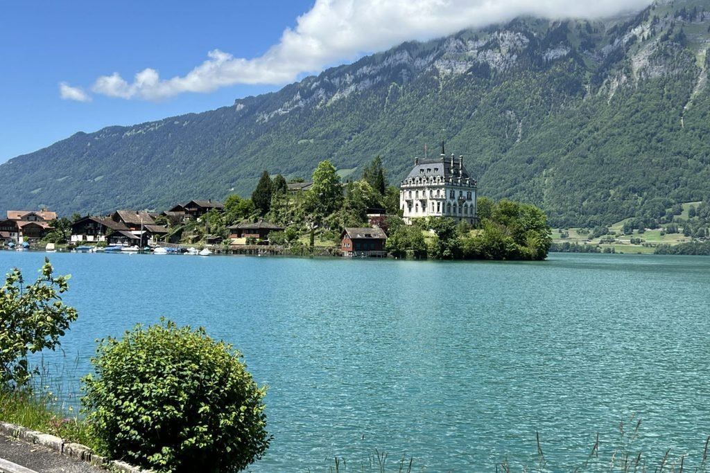
After several days exploring the mountains and valleys around Grindelwald, we decided to venture farther afield and discover the walking trails around Interlaken and Lake Brienz. This part of the Bernese Oberland offers a different landscape, with forested hillsides, turquoise lake waters and waterfalls tucked into the surrounding mountains.
Our day combined a steep downhill hike, a scenic train journey, a boat trip across Lake Brienz and a visit to one of Switzerland’s most impressive waterfalls. It was another full day of exploring, made much easier by the transport connections included in our Bernese Oberland Pass.
Harder Kulm to Interlaken
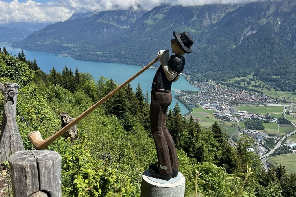
We began our morning with a train journey from Grindelwald to Interlaken, followed by the funicular up to Harder Kulm, one of the region’s most popular viewpoints, sitting approximately 1,322 metres above sea level.
From the viewing platform, we could appreciate some of the Bernese Oberland’s most recognisable scenery:
- Lake Thun and Lake Brienz, stretching out on either side of Interlaken.
- The Eiger, Mönch and Jungfrau, rising above the surrounding landscape.
- Panoramic mountain and valley views, providing plenty of opportunities for photographs before our hike.
Rather than taking the funicular back down, we decided to hike from Harder Kulm to Interlaken, following the descending trail through the forest.
Although walking downhill might sound easier than climbing, this was a fairly steep descent with a considerable change in elevation. The track wound through wooded slopes, with uneven sections requiring careful footing, particularly after wet weather.
As we made our way down, the open mountain views gradually disappeared behind the trees, giving us a completely different walking experience before we eventually reached Interlaken.
Our tip: Don’t underestimate the downhill hike from Harder Kulm. Allow plenty of time and wear suitable hiking shoes, especially if the track is damp. If you have knee problems or prefer a less demanding option, the funicular provides a much easier return journey.
Giessbach Falls and Grandhotel Giessbach
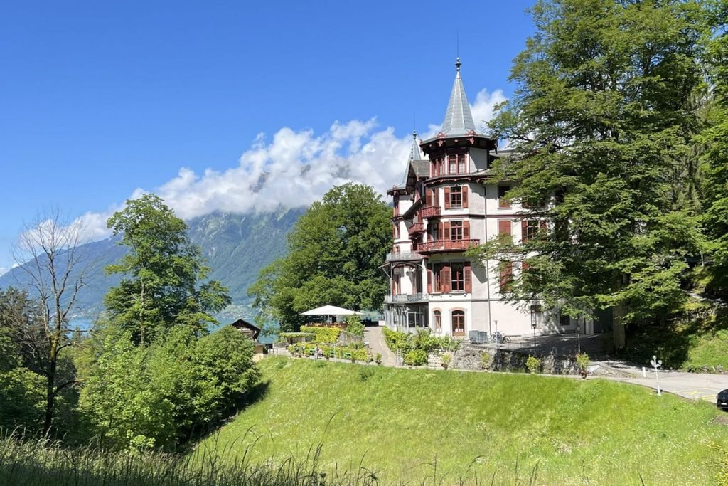
After returning to Interlaken, we caught the train to Brienz, where we’d originally hoped to ride the historic Brienz Rothorn Railway into the mountains. Unfortunately, it wasn’t scheduled to open until 10 June 2024, so we needed another plan.
Instead, we boarded a boat on Lake Brienz, enjoying the journey across its beautiful turquoise waters towards Giessbach. With steep mountains rising from the shoreline and small villages scattered along the water’s edge, the boat trip was an experience in itself.
From the Giessbach boat landing, we walked uphill to explore two of the area’s highlights:
- Giessbach Falls: A spectacular series of waterfalls cascading down the mountainside towards Lake Brienz. Walking tracks lead through wooded surroundings to different viewpoints around the falls.
- Grandhotel Giessbach: A beautiful historic hotel surrounded by gardens and forest, with an impressive position overlooking the lake.
Walking uphill from the boat landing was well worth the effort. We spent time exploring the waterfalls and the hotel surroundings, enjoying the contrast between the peaceful lakeside setting and the powerful cascades.
Afterwards, we continued our journey on foot towards Iseltwald, following the scenic lakeside trail.
Iseltwald and the Lake Brienz Steamboat
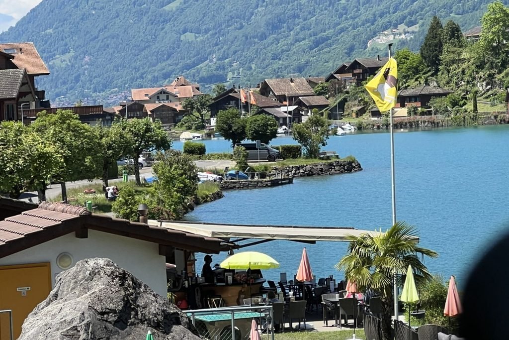
From Giessbach, we continued on foot to Iseltwald, following the scenic lakeside trail through forested sections overlooking the beautiful turquoise waters of Lake Brienz.
Along the way, we enjoyed:
- Peaceful forest walking tracks, offering welcome shade and glimpses of the lake through the trees.
- Beautiful lakeside scenery, with mountains rising above the water.
- Iseltwald village, known for its traditional Swiss houses and picturesque waterfront setting.
After exploring the village, we boarded a historic paddle steamer for our return journey to Interlaken. Cruising across Lake Brienz was a wonderful way to finish a day that had included mountain hiking, waterfalls and lakeside walking.
Lake Brienz is well worth including in a Bernese Oberland itinerary, even if hiking is your main priority. The combination of charming villages, walking trails and boat journeys offers something quite different from the higher mountain routes.
From Interlaken, we caught the train back to Grindelwald, bringing another memorable day of exploring to a close.
Popular Bernese Oberland Hikes That May Still Be Closed in Early June

One of the biggest surprises during our visit was discovering how many popular mountain hikes were still inaccessible at the beginning of June. Although the valleys were green and the lower walking trails were generally accessible, winter conditions were still affecting the higher elevations, with lingering snow and seasonal transport closures limiting our options.
We had several well-known hikes on our wish list, but some simply weren’t possible during our stay. For anyone planning to visit the Bernese Oberland in early June, it’s worth understanding which trails may open later in the season.
Schynige Platte and Brienzer Rothorn
These were two mountain excursions we had particularly hoped to include in our itinerary, but neither was available during our visit.
- Schynige Platte: Famous for its Alpine gardens, mountain views and hiking routes overlooking Lakes Thun and Brienz. Unfortunately, the mountain railway and higher hiking routes weren’t accessible during our early June visit. The area is also the starting point for the challenging hike towards Faulhorn and Grindelwald First.
- Brienzer Rothorn: One of the region’s most scenic mountain excursions, reached by the historic Brienz Rothorn Railway. We had planned to visit during our day around Lake Brienz, but the railway wasn’t scheduled to open until 10 June 2024, after our time in the area.
Although we were disappointed to miss both, having alternative walks in mind meant we could still make the most of our days rather than waiting for conditions to improve.
Other Popular Hiking Trails to Check Before Visiting
Several other well-known Bernese Oberland hikes can be affected by lingering snow during early summer. Their accessibility varies each year, depending on the winter snowfall, spring temperatures and trail maintenance.
- First to Bachalpsee: One of Grindelwald’s most popular mountain walks, leading to an Alpine lake surrounded by dramatic peaks. Snow can remain on sections of the trail in early June, so checking its status before setting out is essential.
- Männlichen to Kleine Scheidegg Panorama Trail: A scenic mountain route with views towards the Eiger, Mönch and Jungfrau. Although lower trails around Männlichen may be accessible, the Panorama Trail can remain closed until snow has cleared.
- Eiger Trail: A famous hiking route beneath the Eiger’s north face, generally walked between Eigergletscher and Alpiglen. Its elevation and exposed mountain setting mean early-season snow can delay access.
- Schynige Platte to First via Faulhorn: A demanding, high-altitude hike connecting two of the region’s best-known mountain areas. This route typically requires more settled summer conditions and should only be attempted when officially open.
These are popular hiking options worth researching, rather than trails we completed ourselves.
How to Check Which Hiking Trails Are Open
Before heading into the mountains, it’s important to check current conditions rather than relying solely on published hiking itineraries or estimated seasonal opening dates.
A few useful ways to plan include:
- Check official trail updates: The Jungfrau Region and local mountain transport operators publish information about hiking routes, seasonal openings and closures.
- Look at mountain transport schedules: Some hiking trails depend on railways or cable cars that only operate during particular months.
- Ask local staff: Tourist information centres, accommodation hosts and transport staff can provide valuable advice about current conditions.
- Have alternative routes planned: Keeping a selection of lower-altitude walks in mind makes it easier to adjust when higher trails are inaccessible.
- Respect trail closures: Snow-covered mountain paths can conceal hazards, even when the surrounding weather appears favourable.
One of the main reasons we couldn’t adjust our hiking dates was the cost of accommodation in Grindelwald. Accommodation can be expensive, and booking well in advance is highly recommended, particularly if you’re staying for several nights. We’d arranged our six-night stay around the beginning of June, so changing our dates to coincide with the opening of certain mountain trails wasn’t really an option. Although we were disappointed to miss some of the hikes we’d planned, we absolutely loved the walks we completed. In fact, exploring the quieter trails and discovering places recommended by locals became some of our favourite memories of the Bernese Oberland.
Planning Your Bernese Oberland Hiking Adventures
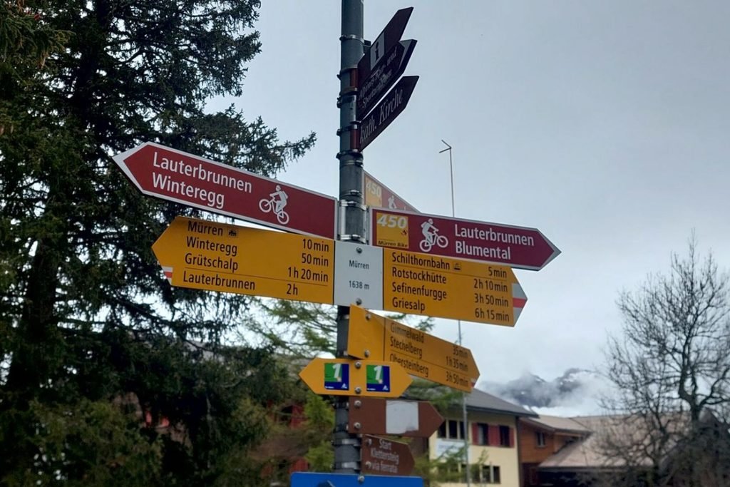
Making the most of a hiking holiday in the Bernese Oberland often comes down to good transport planning. With so many mountain routes connected by trains, gondolas and buses, choosing the right tickets and understanding the timetables can help you cover considerably more ground during your stay.
Using Mountain Transport and Hiking Passes
One of the best things about hiking in the Bernese Oberland is that you don’t have to walk uphill for hours to reach spectacular mountain scenery. The extensive transport network allows visitors to begin walks at higher elevations, connect trails between villages and return using a different route.
During our stay, we purchased a four-day Bernese Oberland Pass, which became one of the most valuable parts of our hiking experience. We also had Swiss Half Fare Cards, which reduced the cost of purchasing our regional passes.
We were determined to make the most of those four days, often heading out early to catch the first available services and planning our return around the later departures. Some days involved several gondola, train or boat journeys alongside hours of walking.
Having the pass gave us the freedom to change our plans when the weather improved. It also allowed us to revisit places such as Grindelwald First without worrying about purchasing another expensive mountain ticket.
Without the pass, we wouldn’t have managed nearly as many mountain journeys and hiking adventures. The cost of purchasing individual tickets would have made us much more selective about where we travelled.
For anyone planning a similar trip, it’s worth considering:
- Where you intend to hike: Different passes cover different transport routes, so check that your preferred destinations are included.
- How many days you’ll be exploring: A regional pass can offer good value when several mountain journeys are planned within a short period.
- Seasonal operating dates: Some mountain railways and cable cars may not be running during early June.
- First and last departures: Check the daily timetables carefully, particularly when combining several walks and transport connections.
- Pass exclusions: Not every mountain excursion is fully included, and some routes may only offer discounted fares.
For a detailed comparison of the options, including what we paid and how much we saved, read our separate guide, Swiss Travel Passes: Which One Is Worth It?
Practical Hiking Tips for Early June
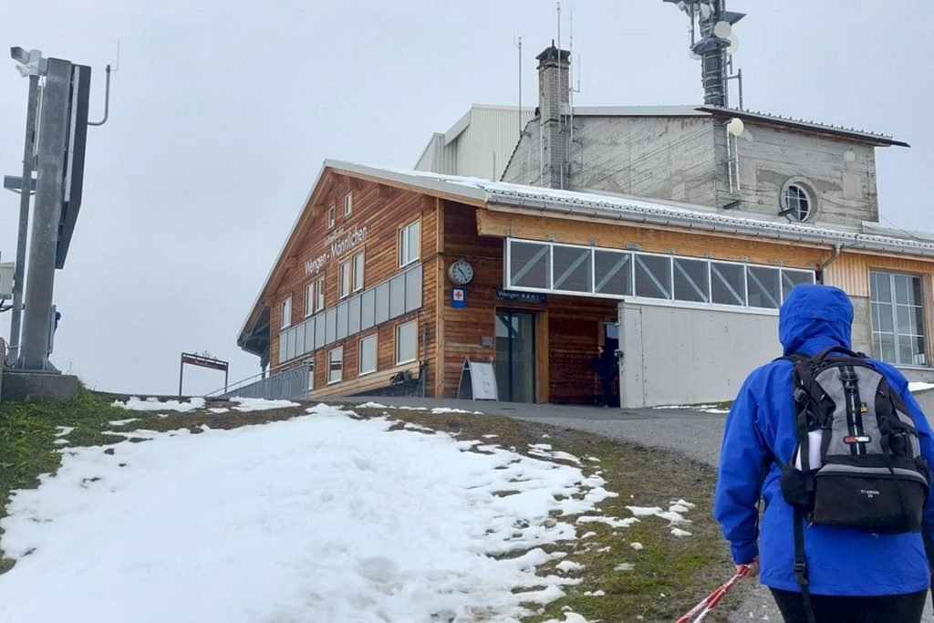
Hiking in early June requires a little more preparation than visiting during the height of summer. Conditions can vary considerably between the valleys and higher mountain trails, and a warm, sunny day in Grindelwald doesn’t necessarily mean the mountain paths are free of snow.
A few things we’d recommend:
- Dress in layers: Mountain temperatures can be much cooler than in the villages, particularly when rain, wind or mist arrives.
- Carry waterproof clothing: A lightweight waterproof jacket and suitable outer layers can make wet-weather walking considerably more comfortable.
- Wear proper hiking footwear: Good grip is important on steep descents, uneven tracks and damp forest paths.
- Check trail conditions each morning: Don’t assume a route is accessible simply because the gondola or railway is operating.
- Carry food and water: Some mountain restaurants and facilities may not yet be open for the summer season.
- Allow extra walking time: Photography stops, changing weather and unfamiliar terrain can make walks take longer than expected.
- Download offline maps: Mobile reception can vary in mountain areas, so having access to your route without an internet connection is useful.
- Ask for local advice: Accommodation hosts, transport staff and tourist information centres can help identify suitable trails and alternatives.
Choosing the Right Hiking Base
Grindelwald is a convenient base for hiking throughout the Bernese Oberland, particularly for visitors wanting to explore several areas without changing accommodation.
We stayed for six nights near Grindelwald Terminal, which gave us easy access to gondolas, trains and local buses. Being close to public transport was particularly useful for our early starts, allowing us to spend more time on the walking trails.
Other popular bases include Wengen, Lauterbrunnen, Mürren and Interlaken. Each offers different hiking opportunities and transport connections, so the best choice depends on which areas you intend to visit.
Final Thoughts
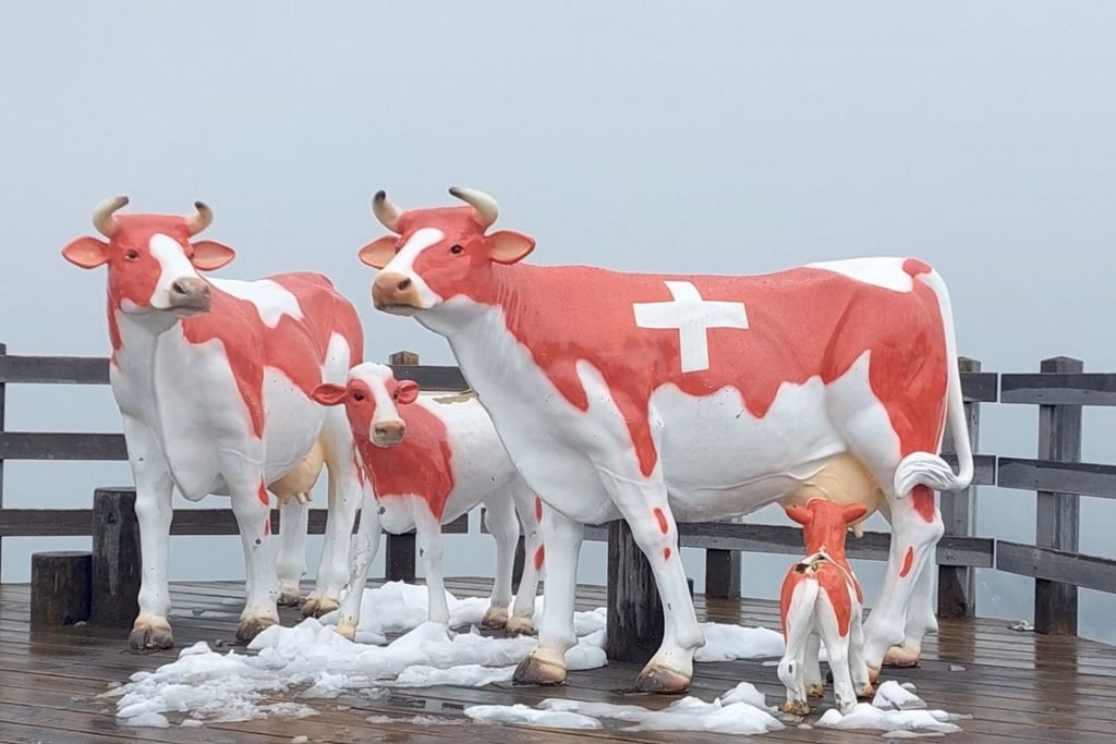
Looking back, what made hiking in the Bernese Oberland so memorable wasn’t just the mountain scenery. It was the unexpected discoveries, the generosity of people sharing their local knowledge and the freedom to follow paths we hadn’t originally considered.
Would we return? Absolutely! We’d love to visit later in the summer and tackle some of the higher trails we missed. But those quieter walks gave us a side of Switzerland we might never have discovered otherwise, and that’s something we’re grateful for.
“The best journeys aren’t always the ones we planned, but the paths we discover along the way.”
🌍 Travel Planning Resources
These are the tools we personally use and trust when planning our travels from finding a place to stay to booking activities, transport and insurance. Let your “Tohu” guide you “Trust the Journey” and follow what feels right for you.
- ✈️Flights – Compare great deals with Trip.com then Kiwi.com for flexible, affordable options.
- 🚐 Campervans – Compare rental deals with Motorhome Republic across Aotearoa and beyond.
- 🛏️ Stays – Compare hotels on Trip.com and TripAdvisor or Booking.com.
- 🚐 Rental Cars – Compare prices and book through Airport Rentals by Motorhome Republic for trusted brands and easy airport pickup.
- 🎟️ Activities – Browse tours and experiences on Viator, Get Your Guide, or TripAdvisor
- 🚆12Go Asia – Compare and book trains, buses, and ferries across Asia in one place with 12Go.
- 🛡️ Travel Insurance – Get flexible short-term coverage with Insubuy for your next holiday.
- 💳 Travel Money – Send, spend and manage money internationally with Wise, with easy currency conversion and a handy option for travellers.
- 🔒 Protect Your Privacy with a VPN – We recommend Surfshark VPN for secure and private browsing while travelling. It’s fast, affordable and works worldwide, perfect for public Wi-Fi at airports, cafes and hotels.
- 📱 Travel eSIM – Stay connected with Airalo
- 💼 Lounge Access – Treat yourself with Priority Pass for UK or US
- 🎶 Events & Concerts – Book tickets worldwide through Ticketmaster.
🧭 Note: Some booking links can be a bit shy when you’re using a VPN. If one doesn’t open, try pausing your VPN or switching to a different server location or secure Wi-Fi network to get things flowing again.